Spatiotemporal dynamics of N2O and CH4 emissions from cropland depressions in Denmark
Nitrous oxide (N2O) and methane (CH4) are important greenhouse gases and emissions from croplands. The temporal and spatial variability in these emissions, particularly concerning “hotspots” and “hot moments” of high emissions, challenge the accurate quantification and process understanding. A recent snapshot study indicated that flooded depressions within cultivated fields across Zealand in Denmark, although covering less than 1% of the total cultivated area, can emit up to 80 times more N2O than the surrounding fields (Elberling et al., 2023). However, the specific spatiotemporal dynamics, key drivers and annual contribution of these emissions remain poorly understood.
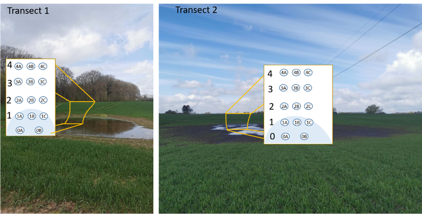
To address this gap, two transects were established in 2019, each extending along a slope from the center of a depression to the uphill area in Sorø, Denmark. The agricultural fields in this region are characterized by small undulating hills and depressions, typical of much of the Danish landscape. At each transect site, five positions were selected, spanning from the depression center to the uphill area (see Figure below). Biweekly in situ fluxes measurements of N2O and CH4 were conducted in triplicate at each position from November 2019 to July 2021. Soil moisture and temperature were recorded simultaneously during each flux measurement, followed by soil sample collections for laboratory analysis of physiochemical properties.
In this project, we use this dataset to quantify spatiotemporal variations in N2O and CH4 fluxes, identify the key drivers behind emission hotspots and hot moments in cropland depressions, estimate the area-based annual N2O and CH4 emissions, and assess the contributions of these hotspots to overall emissions.


